


The Global Peatlands Initiative:
Assessing, Measuring and Preserving Peat Carbon
The Project is aimed to enhance knowledge and capacity to identify, map and sustainable use peatlands globally with special focus of the peatland rich tropical countries Peru, Republic of the Congo, Democratic Republic of the Congo and Indonesia. Furthermore, it will strengthen collaboration of science, policy and economy to contribute to the welfare of peatlands and peatland based communities especially in the southern hemisphere. The Global Peatland Initiative encounters currently 35 members as e.g. the United Nations, the European Union, the ESA, diverse universities, international conventions as Ramsar, WCMC, CBD, WWF, and the private sector.
Project description
The status and importance of peatlands in the global carbon cycle will be high-lighted emphasizing implementing commitments to climate action. Knowledge and data accessibility will be increased by a global assessment, hotspot atlas and platform. Capacities of stakeholders will be built to slow the trend of increasing unsustainable peatland use through GPI expertise. Gaps in global and national policies as well as guidance on peat and climate change will be identified. Partners will exchange and develop policies and approaches to fill the gaps to address peat loss and degradation through innovation, experiences and through SSC exchange.
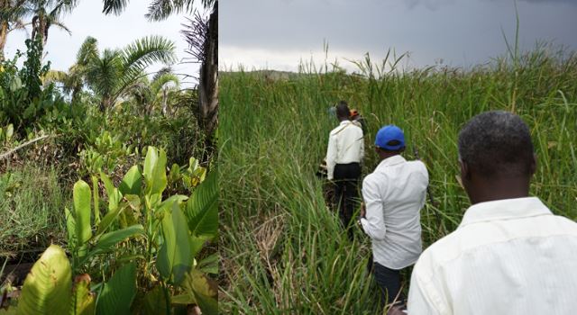
Peru, Indonesia, Congo and the Democratic Republic of Congo will be supported to identify data, capacity needs, policy and guidance gaps on peat and climate change to support them in achieving their (I)NDCs. Options to reduce degradation and improve peatland management through conservation, restoration and sustain-able peat strategies will be shared.
Goals and tasks of the DUENE e.V. staff
- Evaluate technologies and approaches to peat mapping and develop an integrated methodology for a global estimate of peat carbon stocks from different data.
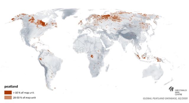
- Conduct an in depth analysis of global peatland distribution and extent, including their contribution to Climate Change mitigation and map global peatland hotspots. Present a more comprehensive and exact coverage of the most important peatland regions globally (area hot spots). Systematically assess all types of peatland disturbance, their distribution globally (degradation hot spots) and their impact on climate change.
- Based on the results of the needs assessment (provided by UNEP), look at options available for data harmonization and mapping methodologies and the possibility of combining existing information and data on peatlands at the national level
- Identify and update national peatland data in the pilot countries which serves as a basis for peatland management and provides information to estimate carbon stocks and emission avoidance.
- Work with partners to integrate peat data derived from the global hotspot atlas into appropriate user friendly tools to support a real time global overview of peat conditions.